
Flora CarbonMeasure
The ground truth for every tree in a carbon project.
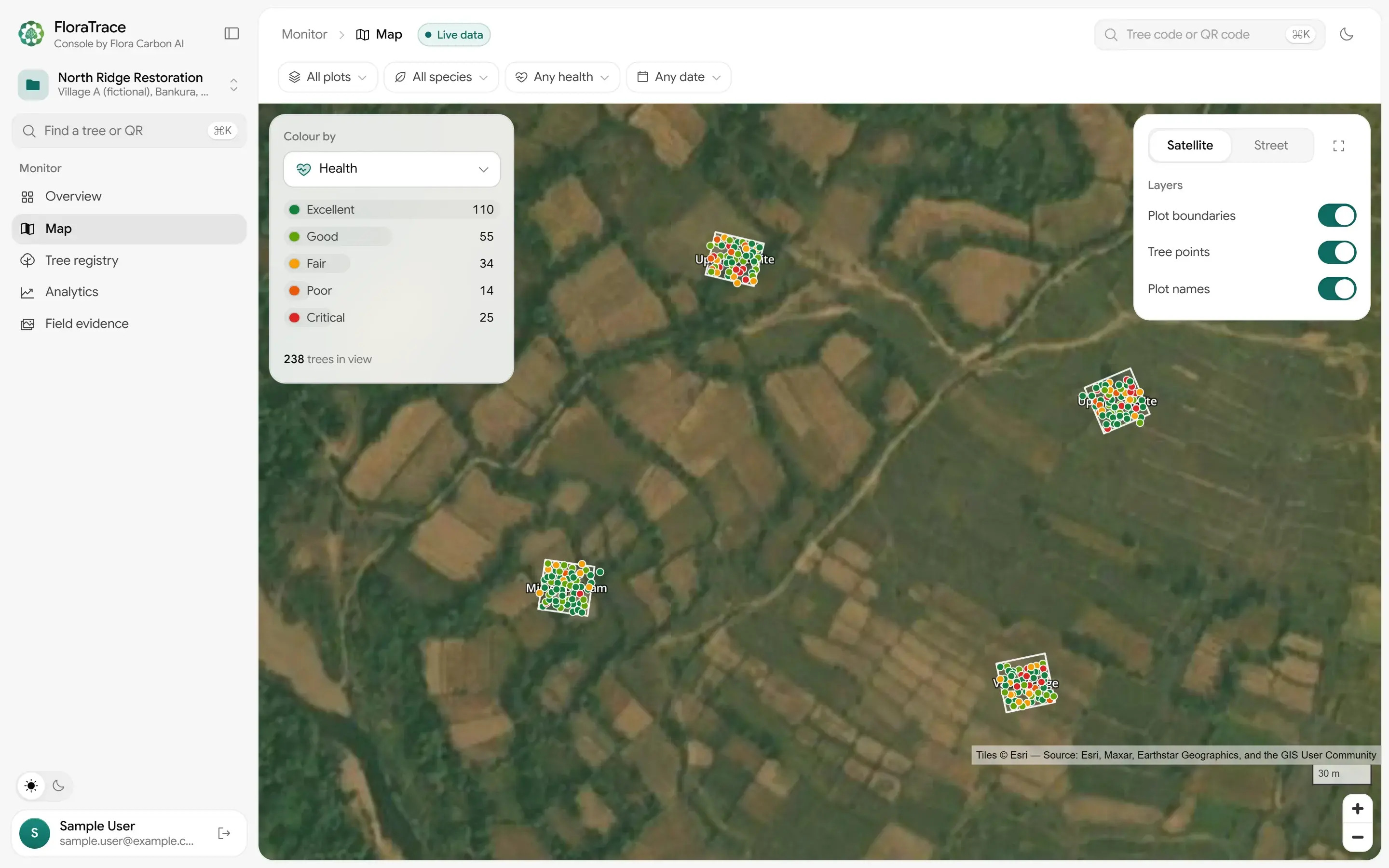
FloraTrace is the field-monitoring module of the Flora Carbon platform. Field teams tag each sapling with a QR code, record where it stands and measure it on every visit. The console turns those records into maps, growth and health, with the evidence behind every number.
Sign in with the account you use in the FloraTrace app.
From the field to the console
The record is made at the tree, with the phone's GPS and camera, in the FloraTrace app. Nothing is copied over from paper later.
- 01
Map the plot
Walk the boundary with the phone's GPS. The app records the plot's outline and area, and who manages it.
- 02
Tag every tree
Print QR labels from the app. Each sapling is registered with its tag, species, planting date, GPS point and a first photograph.
- 03
Measure at each visit
Height, diameter at breast height, canopy spread and health, with photos, the date and the name of the person measuring.
- 04
Review in the console
Records reach the console within a minute of the app syncing, for everyone on the project.
One record per tree, from planting on
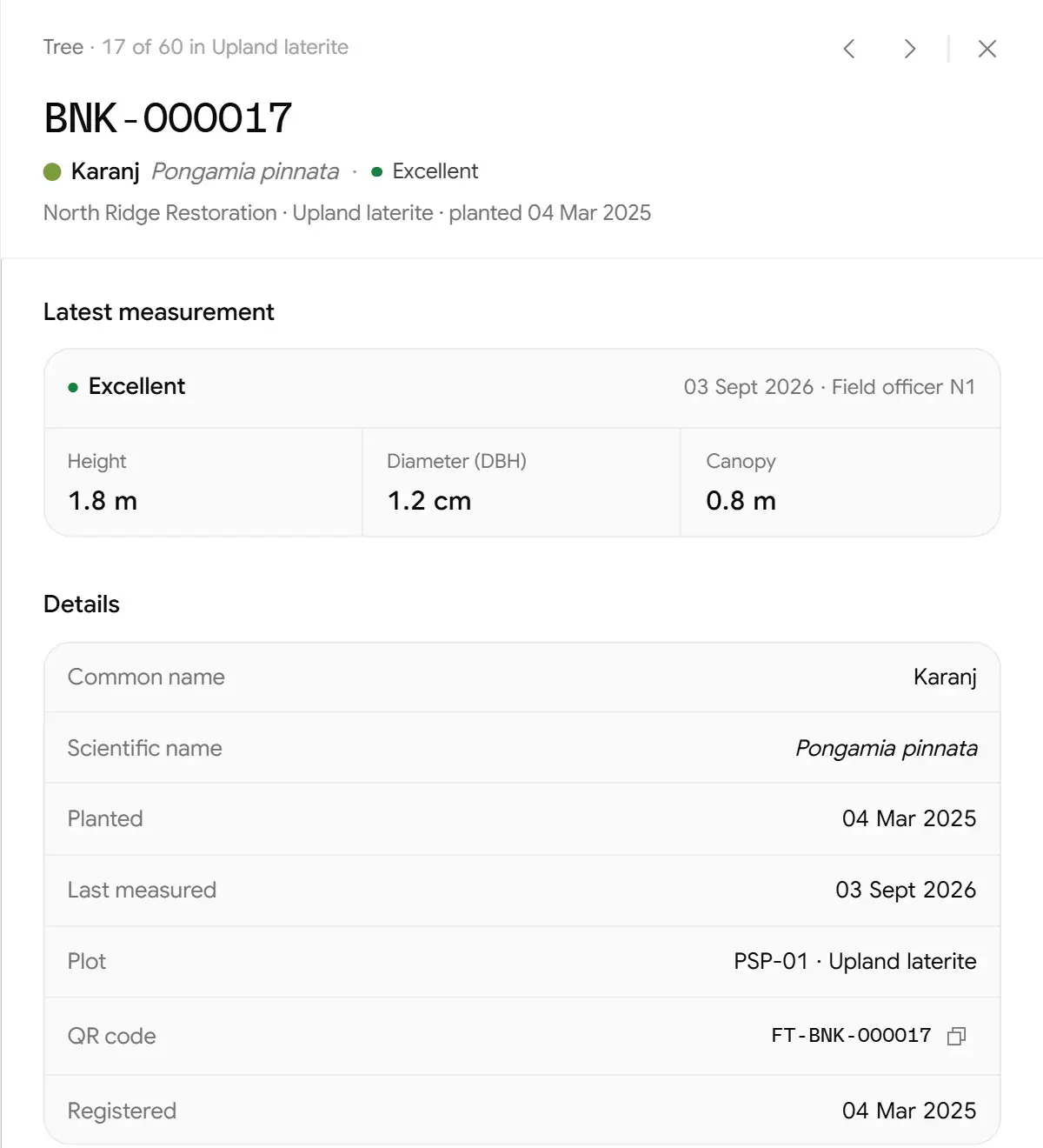
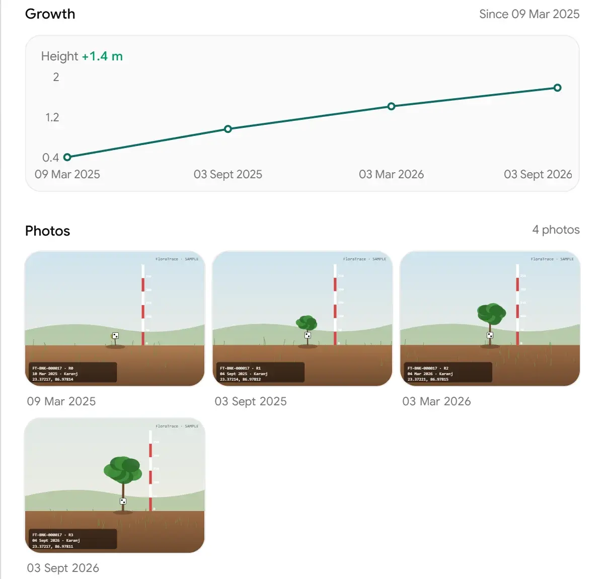
Open any tree from the map or the registry and its whole history is there: where it stands, every measurement, who took it, and the photographs from each visit.
- Tag
- FT-BNK-000017
- Position
- 23.37216, 86.97813
- Species
- Karanj, Pongamia pinnata
- Visits
- 4 measurements with photos, March 2025 to September 2026
- Height
- 0.4 m at planting to 1.8 m
A tree from the sample project. Its photos are illustrations made for the demo.
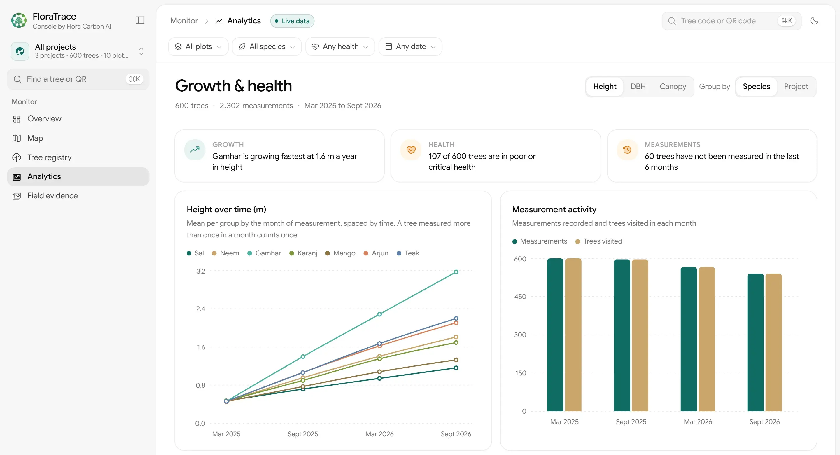
Growth and health, across every plot
Height, diameter and canopy over time by species or project, how many trees were visited each month, and health plot by plot. The console points out trees in poor health and trees nobody has measured in six months, and the registry exports to CSV.
For everyone with a stake in the trees
- Project developers
- Every plot and tree across your projects in one place, with the trees in poor health and the ones overdue for a visit picked out.
- Field teams
- Record at the tree, in the app, under your own account. No paper forms to type up afterwards.
- Partners and buyers
- See what was planted, where it stands and how it is growing, tree by tree, on the projects you are invited to.
- Verifiers
- Go from any figure to the trees, measurements and photographs behind it.
Records made to be checked
Verification runs on what was recorded in the field, so FloraTrace keeps the evidence with each record rather than in a separate folder.
- Photos stay with their measurement
- Every photograph is kept with the visit it was taken on, so each reading has its picture next to it.
- Every reading has a name and a date
- Each measurement records who took it and when, and every visit is kept as its own measurement, so a tree's history stays in view.
- Positions come from the field
- Trees and plot boundaries are located with the phone's GPS, at the tree, when they are recorded.
- Access is per project
- People see only the projects they are members of. A project's owner adds them with its join code.
- The console only reads
- Nothing in the console changes a field record. What partners see is what the field team recorded.
Part of the Flora Carbon platform
Five modules share one project record, from screening the land to measuring the trees. FloraTrace is the last step: per-tree records across the crediting period.
- 01Screen
- 02Select
- 03Quantify
- 04File
- 05Measure
FloraTrace
Already on a FloraTrace project?
Sign in with your FloraTrace app account to see the projects you are a member of.
Planning a planting project?
Talk to Flora Carbon about field access for your team, or about the rest of the platform.